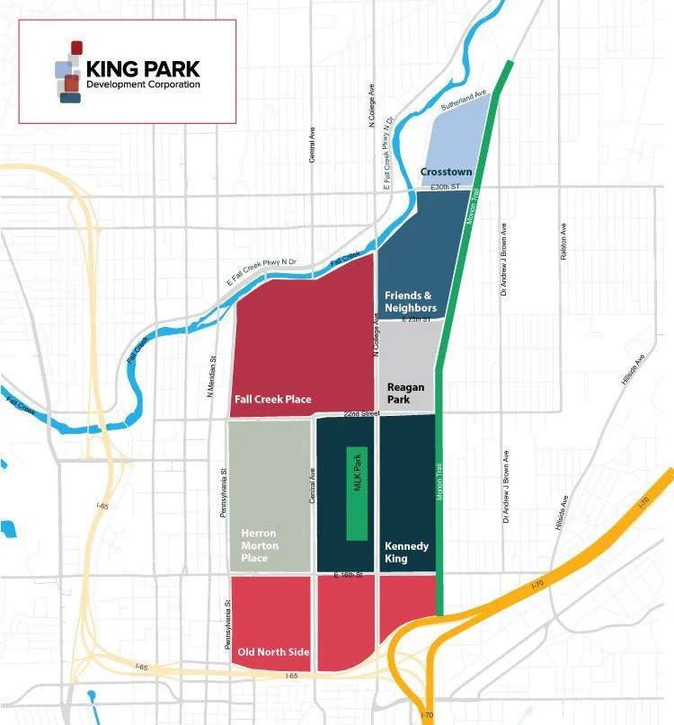
Map of the King Park area. Kennedy-King runs from 16th Street north to 22nd Street, between Central Avenue and the Monon Trail, with MLK Park inside it.
Map: King Park Development Corporation

Where we are

Kennedy-King sits on the near north side, a short walk or ride from downtown.

  • South: 16th Street
  • North: 22nd Street
  • East: the Monon Trail
  • West: Central Avenue

Dr. Martin Luther King Jr. Park sits inside those lines, and we're part of the wider King Park area of neighborhoods.

Parks and trails

All of them are free, and open dawn to dusk.

Dr. Martin Luther King Jr. Park (opens in a new tab)

Nearly 14 acres with a pool, playground, basketball court, and shelter. The Landmark for Peace memorial stands at the south end, recently reopened with new exhibits and walking paths, beside the Kennedy King Park Center.

1702 N Broadway St

JTV Hill Park (opens in a new tab)

Ten acres with a recreation center, playground, shelters, softball diamonds, soccer fields, and basketball courts. Named for James T.V. Hill, one of the first Black attorneys admitted to the bar in Indianapolis.

1806 N Columbia Ave

The Monon Trail

The paved rail trail runs along our eastern edge, linking the neighborhood to downtown in one direction and the north side in the other.

Living here

The neighborhood dates back to the 1800s and is rich in architectural history. It's one of the city's fastest growing urban neighborhoods, and still a quiet one: under a thousand residents in fewer than four hundred households, where people know the names of the folks on their block.

The association organizes clean-ups, block parties, and get-togethers through the year. Everyone is welcome to take part.

Who we work with

King Park Development Corporation

Works across the King Park neighborhoods, including ours, on housing, economic opportunity, and community services, with the aim of keeping the area open to residents at every income level.